
Yuba City ZIP Coverage at a Glance
Yuba City sources show four ZIP values connected to the city, but they do not carry the same level of proof. 95991 and 95993 are the principal delivery codes for incorporated Yuba City, with each also appearing in unincorporated MSAG, or emergency-address, communities. 95992 is associated with Yuba City in USPS label material, yet its current facility role is not confirmed. County GIS returns two active incorporated Woodward Street points coded 95953. That last result is an edge case, not a reason to assign a broad service area. A ZIP code directory must mark verified delivery, likely labeling, and unresolved anomalies separately.
| ZIP | Areas Covered | Post Office | Notes |
|---|---|---|---|
| 95991 | Principal central, east, and south delivery; also unincorporated Tudor and Yuba City MSAG points | Yuba City Post Office, 761 Plumas St., (530) 673-1497 | Weekdays 8:30-5, Saturday 9:30-1; postal and MSAG reach extends beyond the city line |
| 95993 | Principal west and north delivery; also unincorporated Tierra Buena, Live Oak, Sutter, and Tudor/Yuba City MSAG points | Exact separate station not located | Verify a specific address through USPS |
| 95992 | USPS label material associates the code with Yuba City; likely PO-box or nongeographic use | Current facility role unconfirmed | Do not assign neighborhood coverage from the label alone |
| 95953 | Two active incorporated Woodward Street points in the county GIS layer | No separate station assignment confirmed | Local GIS anomaly; USPS validation required |
The Yuba City Post Office listed for 95991 is at 761 Plumas St. and can be reached at (530) 673-1497. Its published hours in the research are weekdays 8:30-5 and Saturday 9:30-1. No exact separate station was located for 95993, so a street address should be checked through USPS rather than paired with a guessed station. The table also shows why a postal city line cannot stand in for a municipal boundary. Tudor appears in the Yuba City MSAG overlap, while Tierra Buena, Live Oak, and Sutter appear in the broader 95993 reach.
The archived USPS L001 label list groups 95991 and 95992 in historical label material for Yuba City. It is useful for context, while a current address result remains the proper deliverability check.
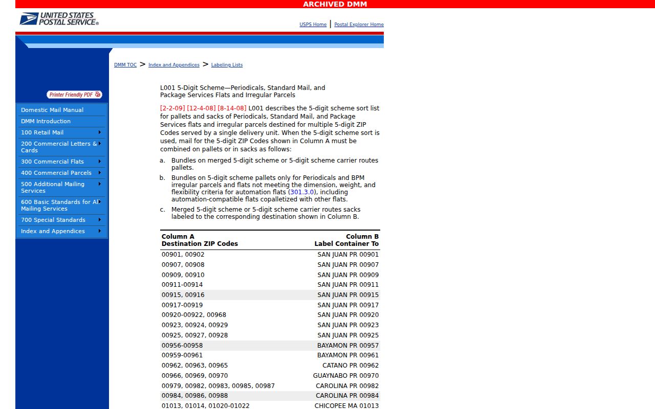
The older label image helps explain why ZIP associations can look broader than the incorporated map. It does not turn a historical list into a current resident or delivery roll.
Four Yuba City ZIP Values Explained
The count changes when the question changes from postal labeling to mapped address points. For incorporated=Yuba City, the county GIS distinct result showed 15,920 points in 95991, 12,094 in 95993, and two in 95953. These are address features, not people, households, or a census count. The two 95953 features are 1338 and 1348 Woodward Street, both active, and YCB is shown as their authority. A ZIP code directory should present those figures as a GIS snapshot with a stated filter, not as a population estimate.
GIS also keeps separate fields for postal community, MSAG community, incorporated municipality, ZIP and ZIP+4. Current and legacy street names, mailable status, lifecycle, placement accuracy, source, address authority, and official assignment can explain a mismatch. A postal label may reach an unincorporated place; an emergency community may follow a different rule; a city line may stop elsewhere. Comparing these fields prevents a reader from treating every Yuba City address line as proof of city jurisdiction.
Yuba City 95991 Delivery Reach
95991 is the clearest central Yuba City delivery pattern. Research places its principal reach in the central, east, and south portions of the city. The same code also appears on unincorporated Tudor points that use a Yuba City MSAG community. That overlap matters when a ZIP search is used to select parcels, request a map, or decide which county record custodian to call. Keep the ZIP result, the incorporated-municipality field, and the parcel jurisdiction as separate columns.
Start with USPS By Address when the goal is mail delivery. Then use the county address layer to see whether the point is incorporated Yuba City or an unincorporated MSAG location. If the search moves to a parcel, use its APN, the parcel tax-map key, or PIN as the stable key. The assessor's system is parcel based and does not provide situs city or ZIP in the internal view, so a missing city or ZIP there is not a reason to discard a valid GIS match.
Yuba City 95993 Delivery Reach
95993 is the principal west and north Yuba City code in the local geography. Its mapped and MSAG reach also includes unincorporated Tierra Buena, Live Oak, Sutter, and Tudor/Yuba City points. Those names explain why a Yuba City postal label can appear beside a community that is not an incorporated Yuba City address. The research did not locate an exact separate post office station for 95993. Do not fill that gap with a guessed facility.
Use the USPS city and state mode to test how the service currently associates a place with the code, then use By Address for the actual delivery point. Archived label lists provide historical context only. They can show how ZIPs were grouped in an older publication, but they cannot prove today's assignment for a street, unit, or parcel.
The archived USPS L007 label list is the second historical source captured for the Yuba City ZIP record. Its grouped labels should be read as archival context, not as a substitute for live USPS verification.
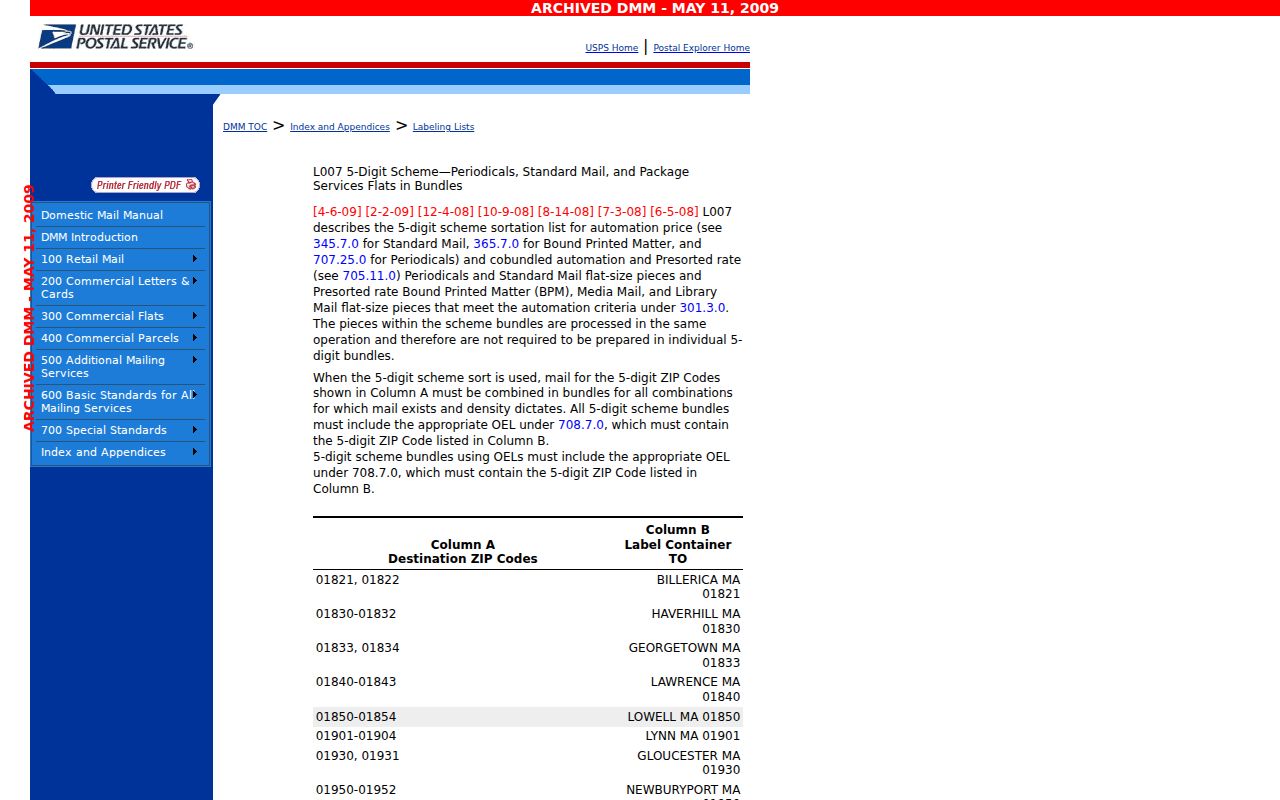
The L007 image gives a second view of historical grouping for 95991 through 95993. A current address check is still needed before a record is placed in a 95993 delivery set.
Yuba City 95992 Needs Verification
95992 is the most important caution in the Yuba City ZIP code directory. USPS label material lists it with Yuba City, and the research treats it as likely PO-box or nongeographic. The current facility role was not confirmed. No neighborhood map, residential count, or broad delivery claim should be built from the label alone. A PO-box code can identify a delivery relationship without tracing a street address, so it belongs in a verification row rather than a normal neighborhood row.
Run USPS Cities by ZIP for the current city association, and keep the result dated with the rest of the research. If a real street address is involved, run By Address and compare the result with GIS postal community, MSAG community, and mailable fields. An archived label can support a historical explanation, but the live USPS response is the final check for deliverability.
Yuba City 95953 Woodward Anomaly
95953 is a small but useful GIS anomaly. The county layer currently codes two active incorporated Woodward Street points, 1338 and 1348, under ZIP 95953. The distinct GIS result is two points, and the authority field shows YCB. That proves what the county layer contains. It does not prove that 95953 is a general Yuba City delivery ZIP, that both points share a postal facility, or that every nearby address uses it.
To investigate, filter the GIS address layer to incorporated Yuba City and 95953, inspect the full address and lifecycle fields, connect each point to its parcel, and note the source and official-assignment fields. Then enter 1338 Woodward Street and 1348 Woodward Street separately in USPS By Address. A mismatch is a verification result, not an error to smooth away. Keep the two points visible as a local edge case until USPS confirms them.
Yuba City ZIP Fields in GIS
County GIS is the strongest ZIP-wide browse because it exposes address fields that the assessor's parcel system does not. The Sutter County One Stop GIS gateway is free and does not require a login. Its public address layer supports distinct values, statistics, order-by, pagination, and distance queries, with a 2,000-record result or selection cap. A ZIP-wide pass should therefore be treated as a set of pages or statistics, not a promise that every point will appear in one screen.
Use the address layer for postal and emergency labels, then join it to the parcel layer for APN, book, page, parcel, acreage, city, and document references. The official assessor parcel-book index places books 51-55 east of Highway 99 and 56-63 west. That map split helps organize parcels, but it is not a ZIP boundary. The fields below are the useful search and review controls. They help explain why a mapped address belongs in a ZIP set, but the layer remains a location index. It does not supply a resident roster or establish who occupies a unit.
| Field Label | Type | Required | Options / Format Notes |
|---|---|---|---|
| 5-digit ZIP | Text filter | No | Start with 95991, 95993, or an edge-case value; compare with ZIP+4. |
| ZIP+4 | Text | No | Narrower delivery code in the address result; not a new city boundary. |
| Postal community | Text | No | May show Yuba City for incorporated and unincorporated points. |
| MSAG community | Text | No | Emergency-address community; compare it with postal and city fields. |
| Incorporated municipality | Filter | No | Use Yuba City when the question is the incorporated city, not every postal point. |
| Current / legacy street | Text | No | Test both forms when a street name or address history has changed. |
| Mailable / lifecycle / accuracy | Flags | No | Review active status, mailable status, placement method, and positional accuracy. |
| Source / authority / official assignment | Review fields | No | Trace the point to its source and authority; these fields are not a USPS ruling. |
| APN / PIN / book-page-parcel | Parcel reference | No | Join the parcel layer for a tax-map key and move to the Assessor when a name is needed. |
Search Yuba City ZIP Codes
A ZIP search works best as a staged check rather than a single residents directory query. Start with the delivery code, then separate mapped locations from parcels and finally decide whether a record custodian can release a name. The county sources document address and APN searches, but they do not turn a ZIP into an unrestricted resident list.
- Set the boundary question. Decide whether the target is postal delivery, incorporated Yuba City, MSAG community, or a parcel set. Write the chosen ZIP and filter in the notes.
- Check USPS. Use By Address for a known street address, By City and State for a city and code association, or Cities by ZIP for the places linked to a code.
- Query GIS. Filter the address layer by ZIP, inspect postal, MSAG, and incorporated fields, and use pagination or statistics when a result approaches the 2,000-record cap.
- Resolve the parcel. Follow the address point to APN, PIN, and book-page-parcel. Use GIS city and parcel layers, since the Assessor's internal view may omit situs city and ZIP.
- Use the Assessor counter for a name bridge. The online assessment search accepts address or APN, but owner names and linked Recorder document numbers are suppressed online. Take the parcel key to 1190 Civic Center Blvd. or call (530) 822-7160; assessor@co.sutter.ca.us is the listed email.
- Handle voter data correctly. My Voter Status is a self-lookup using identifying data, not an open ZIP or street search. Authorized voter-file requests have permitted-purpose rules and do not create a public neighbor list.
- Request an existing city record when needed. The Yuba City City Clerk California Public Records Act (CPRA) process can seek an existing map, address resolution, or annexation record. The city gives a 10-day determination period and allows a possible 14-day unusual-circumstance extension; it does not have to create a custom ZIP roster.
When a ZIP has been narrowed to actual streets, the Yuba City street directory workflow can take over. It begins with address normalization and parcel keys rather than treating the ZIP as the final answer.
Note: GIS pagination can preserve a complete ZIP result, but each address point still needs independent USPS, parcel, and record-custodian verification.
Yuba City ZIP Boundaries and Limits
ZIP boundaries, ZCTAs, and city limits answer different questions. The Census Bureau describes ZIP Code Tabulation Areas as approximations of delivery areas, not legal ZIP boundaries. The Census ZCTA guidance should be read alongside local GIS city-limit and incorporated-municipality fields. In Yuba City, 95991 and 95993 extend into unincorporated MSAG communities, so a postal result can cross the incorporated line. The postal community field is evidence of mailing geography, not a deed jurisdiction or proof of residence.
The Census guidance image below is a useful comparison source for the Yuba City ZIP code directory because it explains why a statistical approximation should not be drawn as a legal city edge.
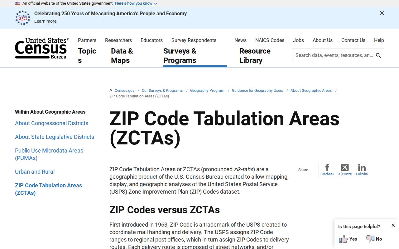
For a local boundary question, compare the GIS incorporated-municipality field with postal community, MSAG, and parcel city. That comparison is more reliable than a city line inferred from a mailing label.
- ZIP code
- A five-digit USPS label used to route mail. It is not a legal city boundary.
- ZIP+4
- The extra four digits in a GIS or USPS result that narrow delivery beyond the five-digit code; it is not a new city or ZIP.
- PO-box ZIP
- A ZIP used mainly for post-office-box delivery rather than a street delivery area. 95992 may fit this pattern, but its current role is unconfirmed.
- Unique ZIP
- A ZIP assigned to one organization or facility rather than a broad neighborhood. No unique Yuba City assignment was documented in the research.
- Carrier route
- A postal delivery route grouping inside a ZIP. It can organize delivery work, but it is not a city-limit or parcel boundary.
Verify Yuba City ZIP Delivery
USPS is the last check for a mailing claim. The official USPS ZIP Lookup provides By Address, By City and State, and Cities by ZIP modes. Those modes are complementary: a city lookup can show a label association, while an exact address lookup tests a specific delivery point. None is a resident search. Use the actual address when the question is whether a letter can be routed.
GIS and the Assessor answer different questions. GIS can show current and legacy street text, postal and MSAG communities, incorporated municipality, ZIP+4, mailable status, lifecycle, and accuracy. The assessment search can start with address or APN, but owner and associated document fields are withheld online and available through the Assessor counter. The county's assessment search help also says its Google map pin is approximate. A ZIP code directory is most reliable when it records each source and does not force them into one boundary.
| Source | Best Answer | Limit |
|---|---|---|
| USPS ZIP Lookup | Current address, city, and ZIP delivery modes | No resident roster or legal city boundary |
| Sutter GIS address and parcel layers | Points, ZIP/ZIP+4, MSAG and postal communities, city field, APN, and map context | 2,000-record cap; location data is not person data |
| Assessor assessment search and counter | Address/APN assessment and the counter bridge to owner, mailing, and document information | Owner and document fields are suppressed online; situs city/ZIP may be absent and the map pin is approximate |
| Yuba City City Clerk CPRA | Existing maps, address resolutions, and other identifiable city records | 10-day determination and possible 14-day extension; the agency need not create a custom list |
That comparison explains why a ZIP-wide resident lookup should stop at a documented address set. If a result has a postal label but no incorporated municipality, keep it in the unincorporated or unresolved group. If the target is a Woodward Street 95953 point, keep both the GIS record and USPS response. If a name is needed, use the parcel key and the Assessor's counter process, not a voter release. The result is a narrower, more honest Yuba City ZIP code directory and a safer starting point for records research.