
Walk the Yuba City Street Directory
A street-by-street search in Yuba City works best as a chain of evidence. Begin with the complete address, then use the county map to locate its parcel and jurisdiction. The parcel number is the bridge between a map point, an assessment result, a recorded instrument, and a permit chronology. That bridge matters because Sutter County addresses can carry a postal city, an MSAG community, and an incorporated-city label that do not mean the same thing. A Yuba City street directory can point to ownership records, but ownership and present household presence remain separate questions.
The clean sequence moves from the least personal location clue to the strongest record custodian. Keep the source and date beside every result. A map can locate land, an assessment result can describe taxable property, and a deed can document a transfer. None should be treated as a complete list of people along a street.
- Normalize the address. Enter the number, direction, street name, type, unit, and ZIP into the Sutter County address or assessment route. Compare the current, abbreviated, and legacy street fields before deciding that two spellings are different places.
- Anchor the parcel. Use the GIS address point and parcel polygon to record the APN or PIN, book, page, parcel, city field, and jurisdiction. Save the map page or appraisal reference when the layer supplies one.
- Read the assessment result. Search by address or APN for situs, assessment, land and improvement data, tax-rate area, and agency context. The online view suppresses the owner and associated recorder document, so do not fill that gap with a guess.
- Use the counter bridge. Take the APN or address to the Assessor counter for the public owner, mailing address, and associated document reference. Search the party in the Clerk-Recorder index, then match the deed image to the APN and legal description.
- Add household context with care. Use My Voter Status only for a requester’s own registration, and use the Library or Museum for historic address clues when a verified collection exists. A restricted voter file is not a public street roster.
The final log should say what was established: parcel location, recorded ownership, permit activity, historic reference, or a possible household clue. It should also say what was not established. That plain separation keeps a street search useful for family history, property research, civic questions, and record correction.
Normalize Yuba City Streets in GIS
Sutter County’s Aumentum public MapServer is a free, no-login route for moving from a street label to map evidence. Its catalog includes Addresses, Communities, Lot Line dimensions, Roads, Tax Parcels, Levees, Cities, Waterways, Assessor pages, Building Footprints, and 2025 aerial imagery. Start with the address layer, then compare the parcel, city, road, footprint, and aerial layers. That order keeps a point address from being mistaken for a parcel or a building.
The address layer preserves more than a single display string. Number prefix, number, suffix, street direction and type, full and abbreviated names, legacy street names, unit information, MSAG and postal communities, ZIP and ZIP+4, incorporated municipality, lifecycle, mailable status, source, authority, official assignment, coordinates, and elevation can all help resolve a hard-to-match street. REST queries support distinct values, statistics, ordering, pagination, and distance functions. The public service has a 2,000-record or selection limit, while a consumer radius button was not verified.
The Sutter County GIS address layer is the documented starting point for the address fields used in a street search.
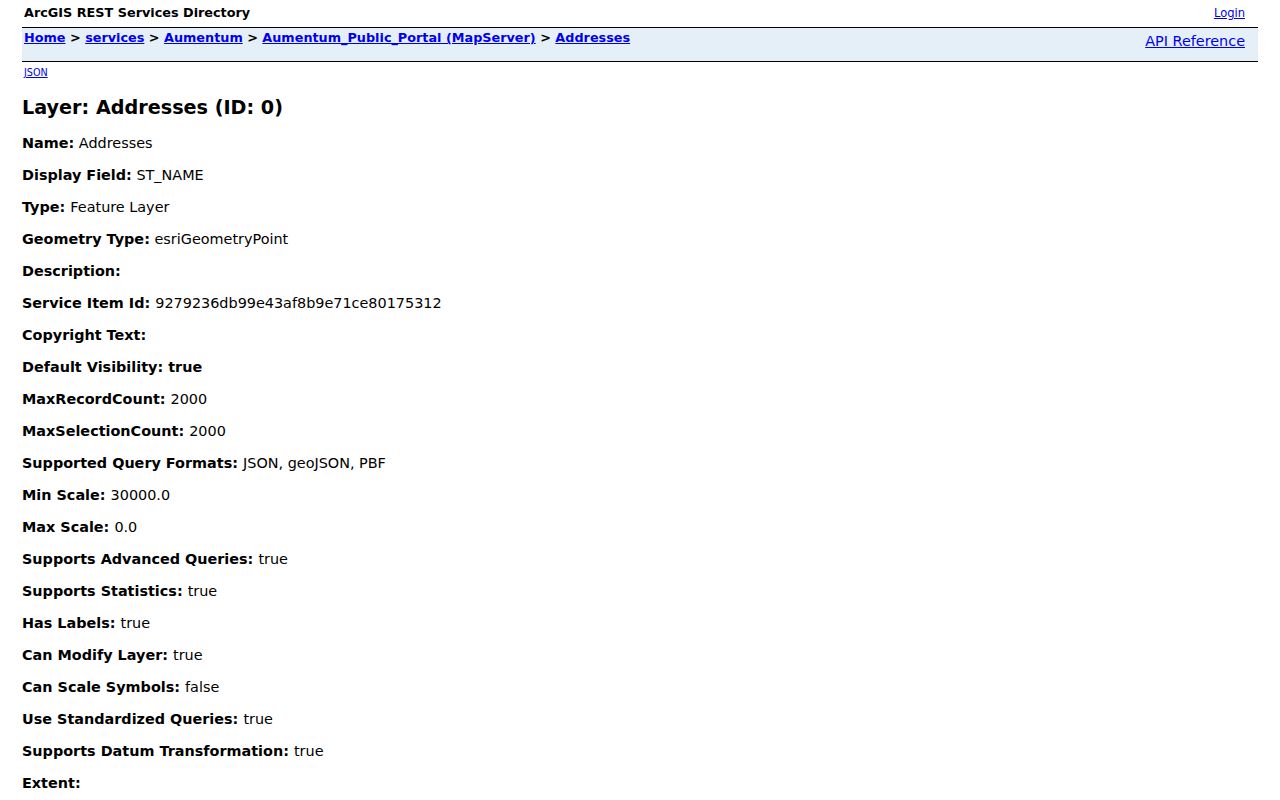
The address view helps reconcile a number with the county’s current and legacy street vocabulary. It identifies a place, not a resident roster, so the next step remains the parcel and its custodian.
Note: GIS pagination can support a working street list, but the 2,000-feature cap means a long query needs smaller segments.
Yuba City Address and Parcel Fields
The Sutter assessment search accepts an address or APN, but it does not offer an online owner-name search. The County’s assessment help explains the parcel-address limits, the difference between situs and billing information, and the approximate nature of the Google map pin. The Assessor map books add a local orientation rule: books 51-55 cover incorporated Yuba City east of Highway 99, while books 56-63 cover the west side. Treat that split as a map-book aid, not as a substitute for the parcel record.
Use the following field set as a capture sheet. The GIS fields supply the street and geography keys; the Assessor supplies the assessment context; the counter supplies the suppressed owner and document references. A blank city or ZIP in the parcel-based assessment system is not proof that the address is wrong.
| Field or key | Where used | What it helps identify | Limit to preserve |
|---|---|---|---|
| Address or APN | Assessment search | Entry point to the parcel result | Owner-name web search is suppressed |
| Number and street parts | GIS address layer | Prefix, number, suffix, direction, type, name | Current and legacy forms may differ |
| Full address, unit, ZIP and ZIP+4 | GIS address layer | Mailing and placement context | Assessor situs city and ZIP may be absent |
| MSAG and postal community | GIS address layer | Emergency and postal geography | Neither one proves incorporation |
| Incorporated municipality | GIS city/address layers | City-limit comparison | Postal Yuba City can extend outside the line |
| APN, PIN, BOOK, PAGE, PARCEL | Parcel layer and Assessor | Stable parcel and map-book identity | APN is not the legal description |
| DOCUMENT, URL, MAP_PAGE, APPR_RCRD | Parcel layer | Linked map or appraisal references | These references do not expose a resident roster |
| Lifecycle, mailable, source, authority, accuracy | GIS address layer | Address status and data quality | Accuracy describes placement, not person identity |
The Sutter County GIS parcel layer carries the APN, book/page/parcel, acreage, city, document, map-page, and appraisal-reference fields that make a street segment reproducible.
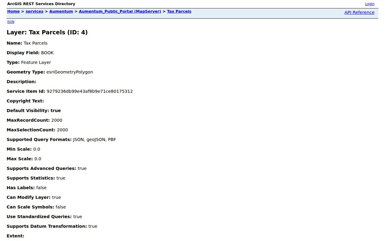
The parcel layer is the handoff point to the Assessor and Recorder. It can show how lots touch and where a parcel sits, while the people-related fields require the separate custodian route.
Recover the Owner at the Counter
Sutter County has an unusual but clear access split: the online assessment view suppresses assessee or owner names and the associated official-record document number, while the Assessor counter is the documented fallback. That is not a sign that the parcel has no ownership trail. It means the web result is designed to show assessment facts without the withheld link.
The Assessor is at 1190 Civic Center Blvd. in Yuba City. The office lists (530) 822-7160 and assessor@co.sutter.ca.us. Bring the normalized address and APN or PIN, then ask for the public owner, mailing or billing entry, and associated recorder reference that is not shown online. The online assessment route remains useful for situs street, land and improvement components, value, tax-rate area, agency context, map links, and appraisal references.
Keep the roles separate after the counter visit. Situs locates the land. Mailing or billing routes a notice and may point to an off-site owner, trust, company, or other recipient. A tax-rate area can name overlapping city, school, water, drainage, cemetery, or other agencies. None of those fields, alone, establishes who is present at the address.
Yuba City Street Records in One Chain
A whole-street search is stronger when each record set has one defined role. The map identifies location, the assessment roll describes taxable property, the counter fills the suppressed owner link, the Recorder documents transfers, and city or Museum sources add time and context. Voter access is restricted, while Library holdings for exact city or reverse directory runs remain unverified. The table keeps those differences visible instead of flattening them into one resident list.
| Address-keyed record | Custodian | Evidence along a street | Access channels |
|---|---|---|---|
| Assessment and tax parcel | Sutter County Assessor | APN or PIN, situs street, values, land and improvement, TRA and agencies; owner and mailing at counter | Address/APN search, counter, phone, email |
| GIS address and parcel layers | Sutter County GIS | Address points, units, legacy names, ZIP, MSAG, polygons, roads, footprints and aerial context | Free map service, REST query, GIS gateway |
| Recorded instruments | Clerk-Recorder | Grantor/grantee names, document type and number, recording date, deed or lien trail | Online index, newer self-service, counter, mail copies |
| Voter information | Sutter Registrar and California SOS | Requester self-status or qualifying file information, not an open street roster | My Voter Status, purpose-limited file request, Registrar contact |
| Permits and code files | Yuba City Building, Code Enforcement, City Clerk | Address or parcel, applicant or contractor, work description, valuation, dates and status when retained | Accela, permit planner, department, CPRA request |
| Historic property records | Sutter County Museum | Selective property descriptions, names, photographs, historic context and street range | Street browse, research form, scheduled visit |
| Newspapers and directory leads | Sutter County Library | Research computers, newspapers and possible local-history clues | In person, phone, catalog or staff confirmation |
| Postal verification | USPS | Address, city and ZIP deliverability modes | By Address, By City and State, Cities by ZIP |
The common key is the normalized address plus APN, not a name typed into every system. Once a counter owner or recorded party is identified, compare the legal description, document date, parcel reference, permit date, and historic source date. When the trail becomes a past-household question, the Yuba City city directory collections route keeps unverified directory claims separate from confirmed deed and map evidence.
Cross the Recorder's Date Divide
The Sutter County Clerk-Recorder is at 433 Second Street, Yuba City, and lists (530) 822-7134, fax 530-822-7214. Real-property service runs weekdays from 7 to 3, recording runs from 7 to 2, and the first Wednesday closes at 2. The general page gives a 2:30 Wednesday closing, so call before a trip. The office describes a daily grantor/grantee index, with research and copy access at the counter and by mail.
The legacy Records Query gateway provides the official index route for 12/1/1993 to the present. Recordings after 3/13/2023 are routed to the newer Tyler self-service portal. A search can use party or grantor-grantee name, document type, document number, recording date or date range, and a fictitious business name mode. Exact current buttons, option lists, result caps, and a sample deed screen were not verified.
Use spelling variants and treat the index as a finding aid. Match a returned instrument to the APN, legal description, document number, and date before carrying a party name along the street. A fee PDF dated 2020 surfaced during research. Its figures need live verification and should not be presented as current. Counter staff and mail copies remain the fallback when an image, older book, or certified copy is not available online.
Note: The online index start, newer portal routing date, and fee-document date describe different limits and should not be merged.
Permit Chronology Along Yuba City Streets
Yuba City Building Division resources, the public Accela application, the permit planner, code enforcement, and city maps provide a second address trail. A permit may show an address or parcel, applicant or contractor, work description, valuation, dates, and status. That can place a change in time or explain a new footprint. The named person may be an applicant, contractor, agent, or other project role, so the permit cannot stand in for an ownership or household conclusion.
The public permit route is useful even with an access gap. Automated inspection of Accela returned a 403 challenge, so exact search fields, result columns, export limits, earliest coverage, and code-case coverage remain unverified. Use the Yuba City permit planner, the department’s code-enforcement and maps routes, or call inspection scheduling at 530-822-4901 when the online screen does not answer the address question.
For existing ledgers or older files, the City Clerk accepts a California Public Records Act request at City Hall, 1201 Civic Center Blvd. Public hours are Monday through Thursday, 8 to 5; Friday is closed, although phone and email services continue. A request should name the existing permit ledger, code file, street-name or address resolution, annexation map, or council record sought. The city gives a 10-day determination window and may take a 14-day extension for unusual circumstances. Search, review, redaction, and assistance are not charged; direct duplication may be.
The Yuba City Accela permit-record application is the documented online route, with the 403 limitation retained as a research caveat.
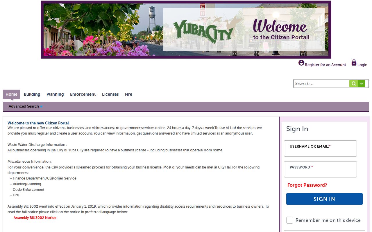
The permit image belongs after the parcel is normalized. It adds a dated public-agency event without changing the meaning of a deed, assessment entry, or household record.
Read Yuba City's Historic Street Files
The Sutter County Museum is the strongest verified local bridge for older street research. Its 2007 historic survey covers 385 properties, including houses, businesses, public and agricultural structures, the Plumas Street district, and Sacramento Northern Railway resources. The Yuba City browse is arranged into 11 street ranges: Almond-Bogue; Bridge-Butte House; C-Chestnut; Colusa-Cooper; Emerson-Kiley; Lincoln-Olive; Onstott-Orange; Park-Plumas; Railroad-379 Second; 406 Second-545 Second; Shasta-Yolo. The survey is selective, not a complete parcel roll, so every name or description needs deed and assessment comparison.
The Museum is at 1333 Butte House Road, Yuba City, (530) 822-7141, info@suttercountymuseum.org, with hours Wednesday through Friday 9 to 5 and Saturday noon to 4. Admission is free. Its research service accepts a form with a topic, names, dates, addresses, material-use choice, and assistance type such as collection, photograph, or family history. Requests are handled in order during scheduled research hours, with no fixed fee or turnaround stated. The Museum historic-properties browse is the street-level starting point.
Sutter County Library Main, 750 Forbes Avenue, (530) 822-7137, offers free research computers and California Digital Newspaper Collection access. It is open Tuesday through Thursday 9 to 6 and Friday through Saturday 9 to 5. The research did not verify exact city-directory, telephone-directory, reverse-directory, obituary-index, yearbook, Ancestry, or HeritageQuest runs. Ask staff or the catalog for a shelf inventory before describing a local criss-cross volume as available. Newspaper work may cross the Feather River because the Museum directs newspaper researchers to Yuba County Library.
For a past household, pair a Museum street file with a deed, assessment, census schedule, cemetery entry, or indexed Bulletin item. The Museum holds 20,000-plus artifacts and 8,000-plus photographs, and its Bulletin indexes run from 1954 through Spring 2026 with gaps. Those resources can supply names and leads without pretending that an unverified directory year is a confirmed record.
Check ZIP Fields Against City Limits
Yuba City street research often meets a postal boundary problem. ZIP 95991 serves principal central, east, and south delivery areas but also includes unincorporated Tudor and Yuba City MSAG points. ZIP 95993 serves principal west and north areas and also reaches Tierra Buena, Live Oak, Sutter, Tudor, and Yuba City MSAG communities. USPS label lists associate 95992 with Yuba City, but its current facility or PO-box role was not confirmed. County GIS currently codes two active incorporated Woodward Street points as 95953, an anomaly that needs USPS validation.
The incorporated GIS distinct results reported 15,920 points for 95991, 12,094 for 95993, and 2 for 95953. These are address-layer points, not counts of residents or households. The USPS ZIP Lookup offers By Address, By City and State, and Cities by ZIP modes. Use it as the final deliverability check. Census ZCTA guidance also treats ZIP Code Tabulation Areas as approximations of delivery areas, not legal ZIP boundaries.
When the ZIP and city fields disagree, compare the incorporated municipality, MSAG community, postal city, ZIP or ZIP+4, legal description, and parcel city field. The Assessor’s parcel system may omit situs city and ZIP, while GIS preserves the address geography. A Google map pin is approximate. A ZIP narrows a search; it does not replace the parcel, city-limit layer, or deed description.
Note: A ZIP label, MSAG community, incorporated boundary, and deed legal description answer different geography questions.
Compare Yuba City Maps and Records
A reliable street directory depends on knowing which source can answer which question. The public GIS catalog is broad, but breadth is not proof of a person. Assessment adds taxable-property facts, the counter supplies a withheld owner link, the Recorder supplies legal instruments, permits add agency chronology, and the Museum supplies selective history. The right source changes when the question changes.
The Sutter County public GIS layer catalog makes the distinction visible by placing addresses, parcels, footprints, roads, city limits, waterways, assessor pages, and aerial imagery in separate layers.
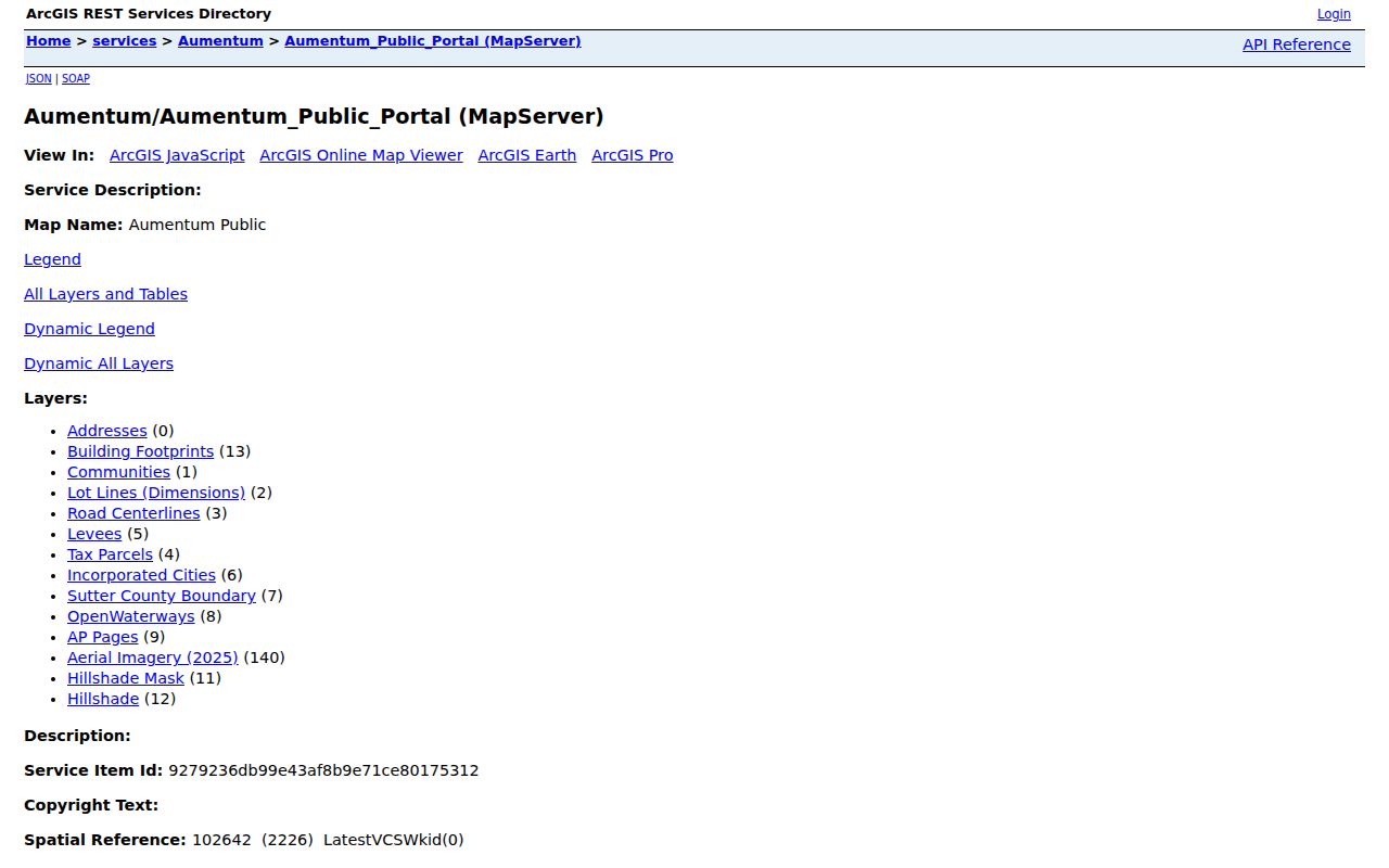
The catalog image is a reminder to inspect layer names before reading a result. A city boundary, parcel polygon, or building footprint can resolve a street question while remaining silent about the people connected to it.
| Question | Strongest starting layer | Boundary to keep |
|---|---|---|
| Where does the address sit? | GIS address, parcel, roads and city layers | Location is not a person |
| Who is tied to the taxable parcel? | Assessor counter, then recorded instrument | Owner and present occupant are different facts |
| What changed title? | Recorder party index and deed image | Index entry needs APN and legal-description review |
| What public work occurred? | Accela, permit planner, code file, or CPRA request | Applicant and contractor roles need labels |
| What older clue survives? | Museum street file, Bulletin, Library or census | Selective or unverified collections need confirmation |
Keeping the sources in their own lanes prevents a strong map result from carrying more meaning than it has. It also makes a later correction possible because the custodian and date remain visible.
Yuba City Voter Records Are Restricted
California My Voter Status is an identifying-data self-lookup. It returns the requester’s registration and election information, such as status, party preference where applicable, precinct, vote-by-mail, ballot, or participation details. It is not a public name-and-street browser. Sutter Registrar of Voters is at 1435 Veterans Memorial Circle, Yuba City, CA 95993, and lists (530) 822-7122 and fax (530) 822-7587. The state voter hotline is 800-345-VOTE.
The California My Voter Status lookup is therefore useful for a person checking their own registration, not for constructing a street list. Access to voter-file data follows a separate purpose-limited application route. Elections Code sections 2187, 2194, and 18109, along with Government Code section 7924.000, protect contact, registration, identifier, and signature data outside permitted uses. Confidential voters and Safe at Home participants are excluded from ordinary release paths.
For a street search, a missing voter result can reflect authentication, statutory limits, a protected record, or a wrong jurisdiction. It does not prove that a person is absent. Use the Assessor, Recorder, GIS, Museum, or Library for the record type each custodian actually holds, and do not ask one office to create a list that it does not maintain.
Note: A voter self-lookup confirms the requester’s election record, not every registered person connected to a Yuba City address.
Limits of a Yuba City Street Directory
A Yuba City street directory is strongest at locating a parcel, tracing a recorded owner, or finding an address-linked agency record. It is not a complete current household roster. A deed documents an interest in land, an assessment record describes taxable property, a permit names project roles, and a historic file describes a selected property. A mailing address may belong to an off-site owner or organization. A map pin may be approximate. None alone proves who is present at a structure.
Household members and protected people may not appear in address-keyed records. DMV residential information is closed under the federal Driver’s Privacy Protection Act and California law. Utility customer accounts are not a public resident roll. Safe at Home substitute addresses, protected voter information, sealed court matters, confidential marriage records, and vital-record eligibility rules can create a lawful dead end. Those limits are part of the record, not a reason to defeat them.
- Parcel
- A mapped piece of land identified by an APN or PIN. It links an address to assessment and map context, but it is not a list of people.
- Situs address
- The physical location assigned to land. It differs from a mailing or billing address and from the deed’s legal description.
- Plat
- A land map showing lot, boundary, road, or subdivision relationships. It clarifies parcel geography without proving presence or ownership by itself.
- Criss-cross directory
- A reverse directory arranged by street or address rather than only by surname. Exact Yuba City publishers, years, and runs remain unverified.
Use address records for lawful personal research such as family history, property history, civic records, consumer safety, or correcting a source record. When a question narrows from a whole street to one person, carry the APN, dates, and custodian into the Yuba City resident lookup workflow instead of turning a street result into a conclusion.
Lawful personal use. Address and parcel records in Yuba City may support lawful research, but using names, addresses, or map results to stalk, harass, intimidate, impersonate, or harm anyone can bring criminal or civil consequences. Stop at a protected boundary and contact the custodian for a proper correction or access route.